30 October 2016
 Few weeks since our Mt. Makiling climb, we were longing to set our feet on a new trail for another adventure once again.
We had been planning to see the "Tatlong Krus" (three crosses) atop a mountain called Mt. Humarap (a part of Sierra Madre mountain range) in a village called Paete in the province of Laguna. Though it remained a plan for quite sometime, finally it turned into reality on a long weekend.
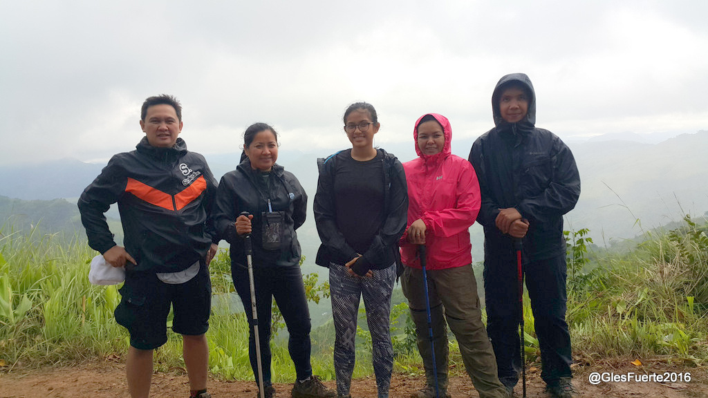
We were five - Myra, Bags, Louise, Jeannie and myself. We left Paranaque at 0705H and headed on to South via SLEX. It was a gloomy morning but the surroundings were dry.
Along the way, we were pranking not to have a breakfast at Delifrance Shell along SLEX to avoid "unwanted events" from happening along the trail, which we had experienced in our past escapades after having breakfast at the said eatery. To cut the long story short, we had our breakfast at Delifrance as our cravings could not resist the tasty menus.
The restaurant was full at that time. I was thinking that maybe most of the customers were travelers, who were escaping the bustling city for a holiday somewhere down south. After patiently waiting for almost 20 minutes, we finally had our breakfast at 0833H.
According to Google Maps, the town of Paete is approximately 111KM away from Paranaque City and a 3H drive on private vehicle.
Along the way, we were pranking not to have a breakfast at Delifrance Shell along SLEX to avoid "unwanted events" from happening along the trail, which we had experienced in our past escapades after having breakfast at the said eatery. To cut the long story short, we had our breakfast at Delifrance as our cravings could not resist the tasty menus.
The restaurant was full at that time. I was thinking that maybe most of the customers were travelers, who were escaping the bustling city for a holiday somewhere down south. After patiently waiting for almost 20 minutes, we finally had our breakfast at 0833H.
According to Google Maps, the town of Paete is approximately 111KM away from Paranaque City and a 3H drive on private vehicle.

The town of Paete, according to Wikipedia, is a fourth class municipality in the province of Laguna, Philippines. According to the 2010 census, it has a population of 23,523 people. The town, is located at the north-eastern part of Laguna, along the shores of picturesque Laguna de Bay. It was founded in 1580 by Spanish friars Juan de Plasencia and Diego de Oropesa of the Franciscan Order. It is believed that the earliest inhabitants were of Malay lineage, coming all the way from Borneo in their swift and sturdy boats called "Balangay".
In addition, Paete is well know for wood carvings so much so that it was called the "Carving Capital" of the Philippines.
At the town proper, we were informed that there is a road for cars that leads to the Tatlong Krus, similar to the road that leads to the peak of Gulugud Baboy in Batangas. The entrance of the road is at Longos.
One thing that surprised me while moving around the town looking for a parking space was the compactness of the village. Commercial and residential buildings were already occupying the supposedly shoulder lane of the highway. Nevertheless, it made me feel cozy.


We parked at the town plaza opposite the old church and the town hall. While parking, we were approached by a man who offered to guide us for the trek to Tatlong Krus.
The Talong Krus can actually be seen from the town plaza. Before starting the trek, I had a chance to move around the church for a few snapshots.


It was a Sunday and a mass was about to start at that time. We were lucky to see the priest at the entrance of the church and asked for a blessing.

The Saint James the Apostle Parish Church also known as Santiago Apostol Parish Church, Saint James the Great Parish Church or commonly known as Paete Church is the only Roman Catholic church in town. Its patron saint is Saint James the Apostle and his feast is celebrated every 25 July.


The church is known for its huge and exqusite collection of images depicting the Passion of Christ, its century-old paintings and wooden images of saints (or poon). The current parish priest is Reverend Father Noel B. Conopio.

Construction of the present church building started in 1864, according to the church administrator.

We started our ascent to Tatlong Krus at 1210H. The jump-off point is actually at the center of the town. We snaked through narrow streets towards the trail that leads to the Tatlong Krus.


The trail is very well organized. In fact, it is actually a winding narrow concrete stairs in the middle of a lush-green and rocky mountain slopes.


From the start of the trail, I counted 298 steps to another trail that leads to the Matabuncca Falls. At the fork, there is a concrete shed and a cool potable water coming from the waterfalls stream.
We resumed trekking at 1256H. From the concrete shed, I counted another 712 steps to the Tatlong Krus.


 We were at the site at 1337H. The three crosses, which are made of concrete used to be wooden crosses, according to our guide. At the area, there are few settlements.


Standing infront of the crosses provides a stunning view of the Laguna de Bay and the town of Paete down below.
After enjoying the place, we started our descent at 1505H and headed on to Matabuncca Falls.
At 1540H, we reached the Matabuncca Falls and it started to rain. As a result, the water coming from the Waterfalls turned murky. The Waterfalls is around 22 meters high.


We were back at the plaza at 1625H and tidy up. There was a last anticipated mass for the day at 1800H which we decided to attend before driving back to Manila.


While waiting for the mass, we had a chance to move around the town to see some souvenirs and wooden sculptures.


We found a nice Coffee and Gallery shop while hopping from store to store. I was personally touched by the warm welcome of the shop owner. The place is nice and cozy.


The architecture of the place resembled a colonial house mostly seen in the Ilocos provinces with sliding windows made of polished capiz shells and colored glass providing a relaxed and yet warm ambiance of the place.


We left Paete at 1928H and while on our way back to Manila, decided to satisfy our cravings and rewarded ourselves with crispy bagnet.
-o0o-