07 August 2016
 Mt. Batolusong is one of the newest hiking destinations near the capital city. According to google maps, it is located at the border of Brgy. Cutambay and Brgy. San Andres in Tanay, Rizal Province.
This increasingly popular new hiking destination is still part of the southern range of the longest mountain terrain in the Philippines, Sierra Madre.
From the the business capital Makati city, Mt. Batolusong is approximately 60 kilometers away and almost 2H drive on private vehicle.
I was at our favorite meeting place in Makati - McDonald Valero at 0200H. We have agreed to start hiking before 0700H this time.
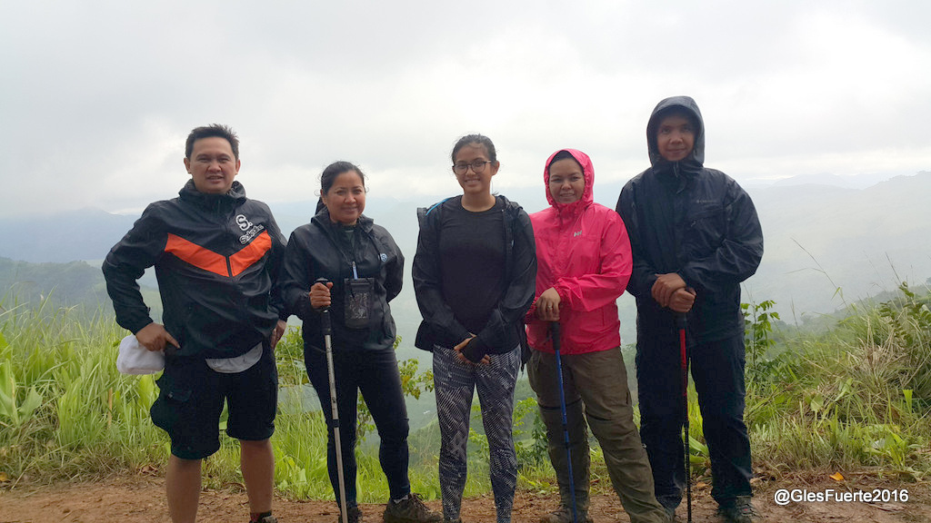
Hiking buddies Myra and team and Janice were with me. We were five. We left McDonald at 0333H and we took Marikina-Infanta Hwy/Marilaque Hwy/R-6.
There was a downpour at Makati and according to the news and accuweather forecast, Tanay in Rizal will be cloudy with scattered thunderstorms and rain showers for the rest of the day.
Given the weather condition, we were contemplating whether to proceed with the climb or postpone it. After a while, we have all decided to drive to Tanay and then see the actual weather condition in the area.
By the time we reached Tanay, it was foggy, so thick that we could hardly see what's ahead of us. It was cold too. There was a light rain. It was too dark.
 We reached the municipality of Sampaloc at 0526H and decided to ask the jeep driver waiting inside his vehicle parked in front of the municipal hall for the direction going to Brgy. San Andres, the jump-off point to Mt. Batolusong.
By the time we reached Brgy. San Andres, we were surprised by the the 2KM (approx) long queue of vehicles parked at the right side of the road. We were lately told by the authorities that there was an organized trail run that already started at 0400H on that day.
At the registration area, we learned that there were seven hundred (700) combined participants for the 12k, 25k and 50k trail run. By learning this information, we had immediately thought that the trail condition going up the summit would not be in good shape.
After a while of discussing, we decided to proceed with the adventure. While we were at the Brgy. hall, it started to rain again and so we had to wear our rain coats. After paying all required fees for the climb and securing a guide, we commenced hiking.
We officially started at 0620H.
We had also decided to complete the trek on the summit of Mt. Batolusong and differed our hike to the nearby higher peak Susong Dalaga because the of the rain and the trail condition.

We had several river stream crossings. We crossed the first stream near the jump-off point at 0635H.

Moving on, we passed through a residential community.

At 0641H, we had another stream crossing. Our guide told us that with a continuous downpour, the streams usually swell making the trail not passable to hikers. We were lucky at that time that though it was raining, the water on the streams remain at a manageable level.

At 0659H, we had a nice group photo shoot with a tiny waterfalls of crystal clear waters.

We stopped and regroup at a nearby water source along the trail. I could tell that there were nearby a hundred hikers at that time looking at the volume of hikers that we met along the trail.

As we moved higher, the trail condition gets worst as a result of the trail run and the rain. The trail turned into a mire. It was thick and sticky and some parts slippery.


There were rock formations along the trail. Just before reaching the Duhatan Ridge, we had to queue on a line of hikers to pose atop a rock formation for a picture with the lush green Mt. Batolusong as background.

At the other side of the trail is where the popular "Sea of Clouds" usually appeared on a sunny day. There was no clearing at the time and so there was no "Sea of Clouds".
At 0859H, we reached the camp site at Mapatag Plateu and then decided to exit via the trail leading to Kay-Ibon falls.
We started our descent at 0905H.
The trail from the camp site leading to the waterfalls is an open trail with lush green cogon grass covering both sides. Many hikers call this trail the grassland.


As expected, the trail was not in good condition at that time. We had to stop to clear our shoes of mud as as it always gets heavy and slippery.


We enjoyed a nice view of the surrounding mountain peaks and slopes. We had fun taking photos while descending.


We reached the waterfalls at 0951H. It was noted that because of the rain, the water turned murky.

Myra's team had a nice cool dip while Janice and I decided to relax on the rocks while watching the trail runners as they crossed the river.


We left the waterfalls at 1023H towards the exit point at Kay-Ibon where we passed through a road turned into a mire for nearly a kilometer stretch.


We reached the highway at exactly 1100H where the tricycles going back to the registration area were waiting. We took two tricycles and headed back to the Brgy. Hall.
We reached the Brgy. Hall at 1120H, had a nice lunch, tidy up and left Brgy. San Andres at 1246H back to the city.
--o0o--
lydia@mail.postmanllc.net
ReplyDelete